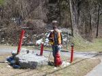
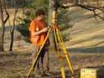
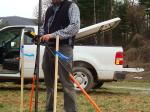
GIS / Data Collection Surveys
McAbee & Associates is an excellent source for municipalities, towns and cities to utilize for mapping and data collection needs on existing or proposed infrastructure systems. Our firm's size, implementation of cutting edge surveying technology and extensive knowledge of large-scale control networks enables us to provide the large amount of data in a rapid and organized format. We are able to easily customize our output data to be seamless with existing Geographic Information System (GIS) department software systems on projects ranging from water, sanitary sewer and storm drainage systems to public street and sidewalk infrastructure systems and studies.
McAbee & Associates is also very capable of managing the mapping, coding and data storage components of a Geographic Information System for a town or municipality. With over 20 years of experience, a large highly skilled staff and extensive knowledge, McAbee & Associates can be a solid partner that you can trust to handle this aspect of your municipal resource management. Please contact us today for more information about these types of services we can provide. .